
Wildfire sentinel during Eastland Complex
Texas A&M Forest Service innovative analysis, technology allowed rapid response
The spring of 2022 was an exceptionally devastating and challenging time for Texans and firefighters during what would become one of the state’s most notable wildfire years. The extreme fire conditions, created by dry grasses and strong winds, caused intense fires to spread rapidly, putting lives and property at risk.
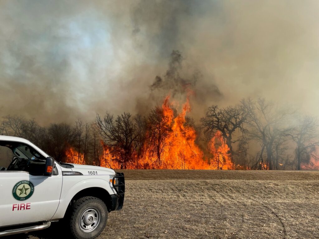
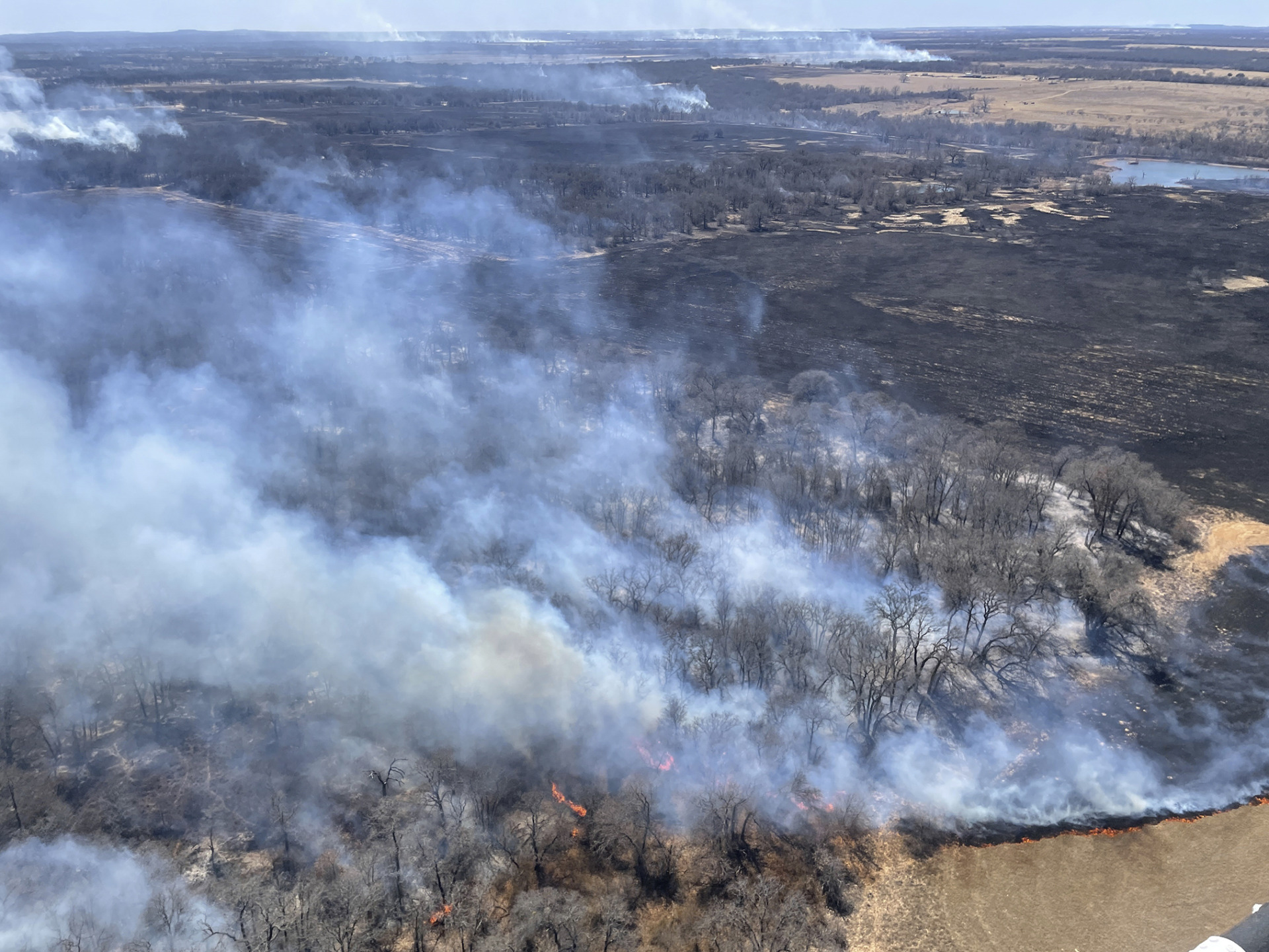
The largest and most destructive wildfires of 2022 were an outbreak of seven wildfires southwest of Eastland in Central Texas. Multiple fires in a geographic area are typically managed as a “complex” to efficiently manage resources and expedite response. The Eastland Complex, which began March 17, burned more than 54,000 acres by the time it was contained on March 31.
The Eastland Complex included:
- Walling Fire, Eastland County – 383 acres
- Kidd Fire, Eastland County – 42,333 acres
- Wheat Field Fire, Eastland County – 7,268 acres
- Oak Mott Fire, Brown County – 4,031 acres
- Blowing Basin Fire, Eastland County – 258 acres
- Mangum Fire, Eastland County – 11 acres
- Cedar Mountain Fire, Eastland County – 229 acres
Getting firefighting resources in place ahead of time
Before the Eastland Complex wildfires ignited, Texas A&M Forest Service predicted the increased wildfire risk for the region and responded, likely saving countless people and properties in the process.
Embedded within the agency as a part of its greater disaster response approach to keep Texas prepared, the Predictive Services and Applied Technology departments operate every day to forecast trends, determine high-risk areas and provide firefighters and fire managers the information they need to make decisions for their areas.
For example, the Predictive Services Department, in partnership with the Spatial Sciences Laboratory in the Department of Ecology and Conservation Biology with the Texas A&M College of Agriculture and Life Sciences, has developed a suite of fire danger and fuel analysis products and maps that provide daily, weekly and seasonal outlooks for dangerous wildfire threats.
With the help of these information sources, Texas A&M Forest Service can coordinate preemptive resource staging to reduce wildfire risk, suppress wildfires and take quick, effective action to contain them.
“Leveraging this advanced technology allows the state to be proactive when preparing for and responding to wildfires,” said Wes Moorehead, associate director of forest resource protection and fire chief at the Texas A&M Forest Service. “There is no doubt in my mind that proactively utilizing this technology has saved lives, homes and critical infrastructure from wildfire.”
And, in March 2022, Texas A&M Forest Service had its work cut out for them.
“There is no doubt in my mind that proactively utilizing this technology has saved lives, homes and critical infrastructure from wildfire.”
Wes Moorehead, associate director of forest resource protection and fire chief at the Texas A&M Forest Service
Data-driven intel shaped informed decisions
Building up to March, the state had already witnessed a steady escalation of fire activity. The fires were growing as vegetation across the landscape dried out. As a result, Texas A&M Forest Service placed resources in high-risk areas of the state to prepare for the inevitable.
About a week before the Eastland Complex fires, Predictive Services diagnostic tools and forecast maps showed a high probability of a wildfire in the Eastland area.
Texas A&M Forest Service fire analysts and their National Weather Service counterparts agreed with forecasts indicating a high likelihood of a Southern Plains Wildfire Outbreak, or SPWO.
An SPWO is an extremely dangerous high-impact weather event. Wildfires that ignite during these events often exhibit extreme fire behavior and rapid growth, making them difficult to control and often prompting evacuations of communities.
“Our forecasters look for specific weather elements, and when they align with a dry landscape, we get the fire effects on the ground that we saw with the Eastland Complex,” said Brad Smith, department head of the Predictive Services Department of the Texas A&M Forest Service. “The fires grow rapidly and don’t care what’s in front of them.”
As each day’s data showed the increased likelihood of an SPWO event, Texas A&M Forest Service coordinated with local entities to mobilize firefighting personnel and stage heavy equipment and aircraft in the highest probability areas.
“Wildland firefighters are highly skilled and well-trained personnel,” Moorehead said. “However, the number of wildland firefighters in Texas and nationwide is limited. When we mobilize personnel in advance of a wildfire, we aim to be strategic, ensuring the right resource is in the right place at the right time. Predictive Services allows us to ensure we have a more efficient and targeted response for a state as big as Texas.”
Texas A&M Forest Service is requested by the local jurisdiction when a wildfire becomes complex and additional personnel or specialized equipment is needed. Without this technology and corresponding data, the agency would not be able to accurately identify areas of concern to position personnel and equipment ahead of wildfire danger. A quick response helps to keep wildfires relatively small, Moorehead said.
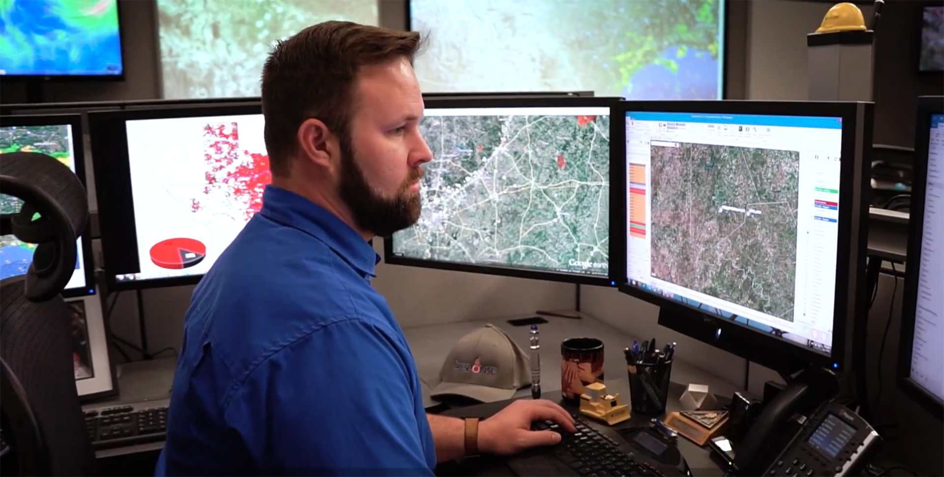

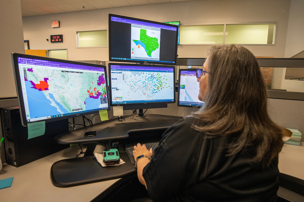
State-of-the-art command center coordinated wildfire response
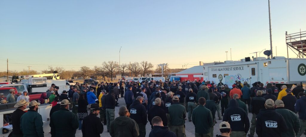
During wildfire season, Texas A&M Forest Service’s Emergency Operations Center in College Station is busy around the clock.
Agency leadership and Predictive Services fire analysts host several briefings each week for personnel, cooperating agencies and partners, such as local fire departments and the Texas Division of Emergency Management to discuss current conditions and the wildfire potential.
From the Emergency Operations Center, Smith conducted a fire potential briefing conference call on the days leading up to March 17 with the command staff and leaders on the ground in the Eastland area. He covered forecast scenarios that could affect operations. For example, if winds were too strong, aircraft might not be able to take off, or retardant might not be as effective because it would blow off the target area.
With these predictive tools, firefighters were on notice of what the situation could become and prepare strategies so that if a fire outpaced their suppression abilities, they could focus on evacuation.
Getting the word out
At the morning briefing on March 17, Smith reported that the data showed conditions were extreme, and the agency launched a messaging campaign to alert the public that conditions were dangerous.
“Texas A&M Forest Service drafted a message for the Texas Law Enforcement Telecommunication System to send to law enforcement and county officials, with specific information about what was likely to happen and in what areas,” said Erin O’Connor, lead public information officer with the Forest Resource Protection Division of Texas A&M Forest Service.
The agency sent out targeted messaging through press releases, social media and other media contacts, O’Connor said. The March 17 wildfire alert warned the public that dry fuels, winds gusting to 40 mph and low humidity could make fires difficult to control and create the need for evacuations.
In addition, the Texas Department of Transportation used billboard messaging to alert the public of extreme fire danger. Texas A&M Forest Service collaborated with the National Weather Service to be ready to issue fire warnings to alert communities if a fire threat was headed their way, similar to how tornado warnings are released.
Timely information, analysis is crucial
The Emergency Operations Center became a busy communications hub of phone calls, radio traffic and dispatches as the agency responded to 10 wildfires across the state as well as the Eastland Complex.
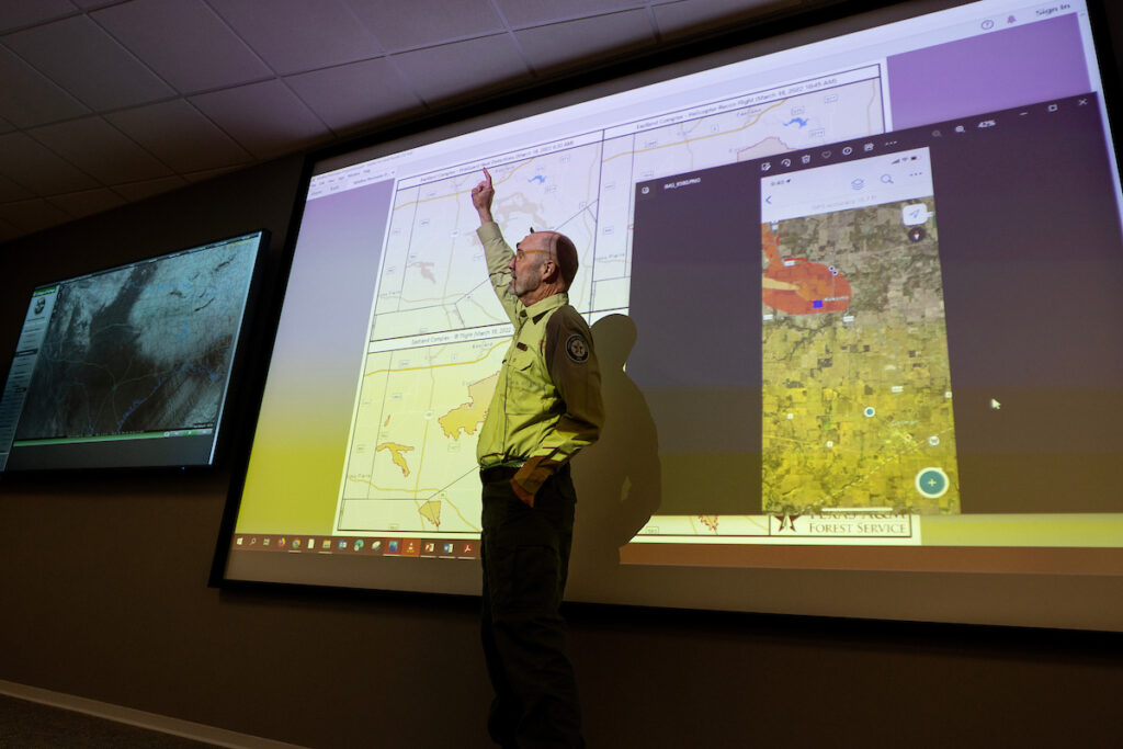
Real-time maps and other information products created by the Applied Technology Department were continually updated and sent to personnel and county-level decision-makers. These maps showed the fire landscape, location and size of each fire, helping determine which ones local fire departments could contain and which ones would need Texas A&M Forest Service response.
The Applied Technology department maintains the Geographic Information System, GIS, infrastructure and servers hosting many Predictive Services analysis and management products.
“Our work with Predictive Services is a team effort to take data and provide more accurate and readily available information so decision-makers can protect lives and property,” said Don Hannemann, Applied Technology department head.
Just as they did with the Eastland Complex, the Applied Technology analysts used national and Texas-specific information to create products that made firefighters’ duties easier and safer. For example, Moderate Resolution Imaging Spectroradiometer, or MODIS, satellite technology uses an instant infrared detection system that shows hotspots where ignitions are occurring as well as the intensity of the fire. Similarly, in a national FireGuard program, the National Guard provides declassified Department of Defense satellite imagery, digitizing images showing fire perimeters.
Hannemann said Applied Technology harvests that data for the firefighters’ maps so they have an initial sense of the size and scope of the fire before they even arrive on the scene. In the case of the Eastland Complex, Smith said knowing where the fire was and where it was heading helped county officials plan evacuations and how people could leave an area. As a result, the cities of DeLeon, Rising Star, Gorman and Carbon were evacuated as 2,384 people went to temporary shelters.
The department leverages ArcGIS Field Maps, the standard for mapping wildland fires, allowing the firefighter in the field to coordinate via an online map. As firefighters enter information about the fire perimeter, dozer lines, staging areas and other points of interest, the map is updated, and everyone is on the same page the second it is updated, said Hannemann. Other agencies, partners and out-of-state firefighters helping in the response also have access to the maps.
Those instant inputs from the field are crucial for the Emergency Operations Center to see the status of an individual fire as well as all active fires, watch the containment progress and prioritize resources as needed, said Moorehead.
“As firefighters input information and data into these applications, fire managers and agency leadership have real-time visibility of the operations and actions being taken on the wildfire,” Moorehead said. “Between FireGuard and the insight our personnel provide from the field, we have valuable information to determine the necessary personnel and equipment for each fire.”
Applied Technology uses helicopter reconnaissance and infrared images from aircraft that can “see” through smoke. That data is used to update maps, showing hot spots as well as the leading edge of the fire. Although Texas A&M Forest Service does not own aviation resources, it uses federal aviation contracts through the U.S. Forest Service and Bureau of Land Management for all firefighting aircraft needs.
Resources for Eastland Complex fire:
- Texas A&M Forest Service: 64 personnel, 22 dozers, two motor graders
- Aviation: Six Fire Boss single-engine air tankers, three large air tankers, four air attack platforms, two aerial supervision modules, one infrared aircraft, three helicopters
- Out-of-state: 134 personnel, four dozers, four engines
- Texas Intrastate Fire Mutual Aid System: Eight strike teams, which include 95 personnel, 30 engines, two water tenders
“One of my roles is wildfire suppression,” said Luke Kanclerz, fire analyst in Henderson. “The ArcGIS Field Maps application is extremely valuable in giving us real-time situational awareness. Each year the technology improves exponentially and helps us be more effective in the field.”
Real-time response and support throughout a wildfire incident
From March 17 until the Eastland Complex was contained on March 31, Emergency Operations Center personnel worked nonstop, monitoring conditions, producing timely maps, updating what was happening on the fire scene and pushing that information to firefighters, county officials and the public.
Applied Technology mapping tools were also instrumental in compiling data for the post-fire assessment of structures and homes that were destroyed or damaged. A total of 158 structures were lost, and 1,147 homes saved during the Eastland Complex.
Timely information, analysis is crucial
Quick and effective communications of the fire risk proved to be key to the lead time and information needed to safely evacuate Texans in the area.
“Not only does the instant communication and data tracking during a wildfire response give everyone on the scene a common operating picture, but this technology allows our agency to make the best decisions that prioritize life safety of both firefighters and the public,” Moorehead said.
“We can’t change what the weather, fuel conditions and fire environment are going to do, but we can communicate it,” Kanclerz said. “There were days when we knew what was coming and that it would be a rough day for folks in the communities being impacted. But it’s also why we must keep doing what we do in Predictive Services and Applied Technology – disseminate more information and better analysis to reduce the effect of wildfires in Texas.”
On March 17, 2022, Deputy Sergeant Barbara Fenley died in the line of duty while assisting with evacuations during the Eastland Complex. Sergeant Fenley joined the Eastland County Sheriff’s Office in 2013 after working with the Gorman Police Department for 10 years. We honor her life of service and dedication to protecting Texans.
Texas A&M Forest Service


